The History
The mouth of the Moore River was originally known as Gabbadah, meaning a mouthful of water. The area has been used by the Yued people for eons, and for general recreation since the earliest days of white settlement in the Gingin district.
Around 1905, a 100 acre block at Gabbadah, owned by Henry Brockman, was made a reserve for picnicking and camping. A well and 3 cottages were built in 1907, people were charged one shilling per week for the use of these cottages.
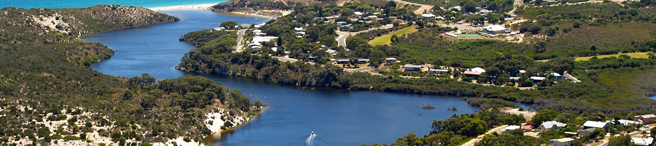
The new town of Guilderton was gazetted on 30th November 1951, named when guilders from the Dutch sailing Ship ‘Vergulde Draeck’, wrecked north of Seabird in 1656, were found nearby. The strong affection which the population of the area felt for the Gabbadah district was reflected in the ‘site-sensitive’ design of the settlement, with large areas of native vegetation preserved within the townsite. The Quindalup dunes south of the river were too infertile for either pasture or crops, and their rich biodiversity was spared from being cleared for agriculture. Urban development took place only on the less fragile north side of the estuary.
The Moore River has a catchment of over 12,000 square kms and its main source is Dalwallinu over 200km inland. The river flows westward through Moora and Mogumber descending the Dandaragan scarp near Regan’s Ford, southwards to join Gingin Brook at Neergabby, becoming an estuary at Boobabbie Bridge (which is now inaccessible), and flowing to the ocean at Guilderton, when the sandbar is open. Ground springs also feed the river at several places along Gingin Brook and the estuary.
Mogumber is where the Moore River Native Settlement was established by the State Government in 1917. In 1951 it became the Mogumber Native Mission managed by the Methodist Church, closing in 1974. It was taken over by the Aboriginal Land Trust and now has the name ‘Budjarra’.
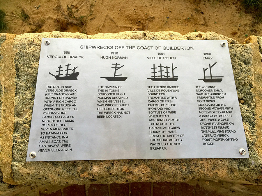
Shipwrecks